Mount Scenery


The monumental inactive volcano Mount Scenery completely dominates the panorama of Saba Island. In fact, Saba is actually made up entirely of the Mount Scenery volcano, whose peak rises above sea level.
The volcanic lava has created fertile soil on which banana plantations were built in the past.
Mount Scenery is the main tourist attraction on Saba.
Find out the prices of flights to Saba
The highest mountain in the Netherlands
As Saba, along with the islands of Bonaire and St. Eustatius, is part of the Caribbean Netherlands, and this, with its special municipality status, is a direct part of the European Netherlands, if you want to climb the highest peak in the Netherlands, this is where you need to go.
The Vaalserberg, the highest hill in the European part of the Netherlands, measures just 323 metres, while Mount Scenery on Saba climbs to 877 metres above sea level.
At the same time, Mount Scenery is the highest mountain in the entire Kingdom of the Netherlands, as there are no higher mountains on the islands of St. Martin, Aruba or Curaçao.
Hike up Mount Scenery
Popular hiking trails from three directions lead to the very top of the mountain.
Mount Scenery is the most visited place in Saba, but even so, you are likely to encounter no more than units of people during the climb to the top. On weekdays, you'll often be all alone on the mountain.
From Windwardside
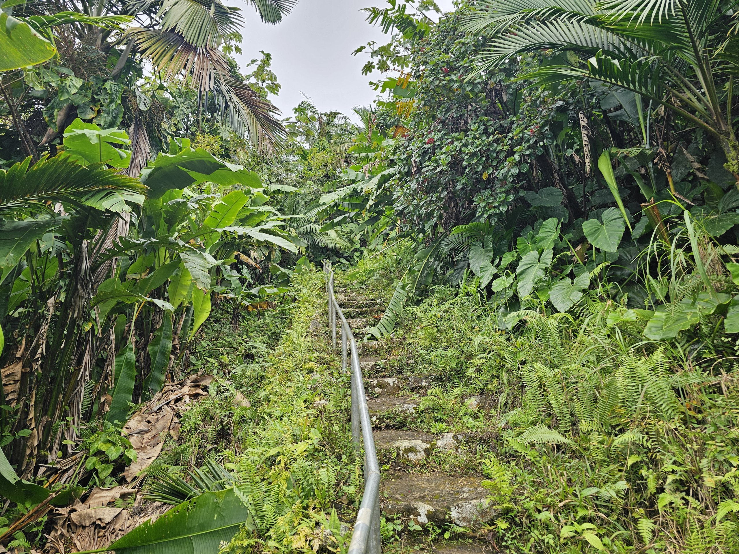
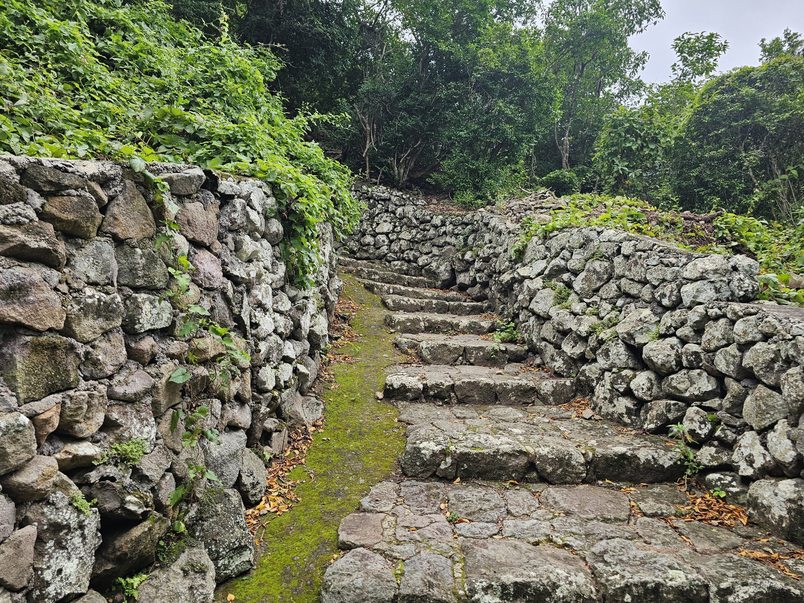
The most popular hike leads from the popular town of Windwardside.
This route is the most groomed and least muddy. In fact, it is made up of partially worked stones and steps, and there are railings running almost the entire length of the trail.
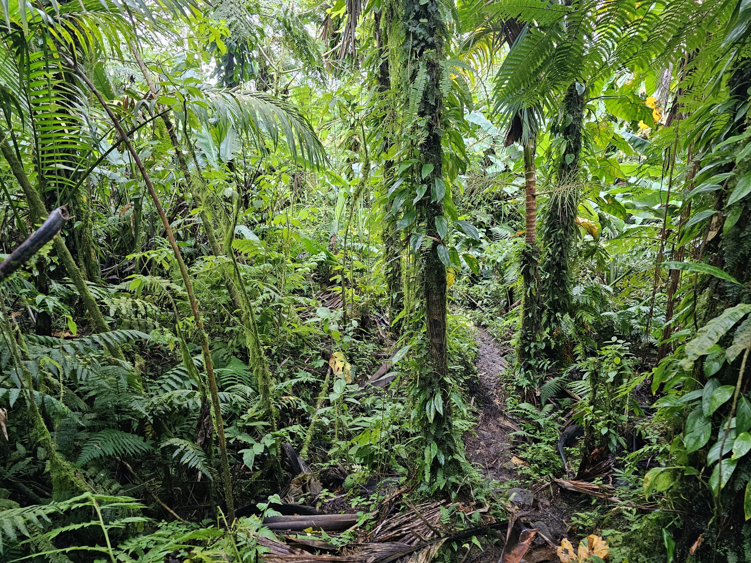
Much of the path runs through jungle mixed with former banana plantations.
The trail is called the Mount Scenery Trail and is the easiest of all the trails. However, apart from the summit, there are no views along the way.
The rocks are slippery after rain and in wet conditions, but the railings greatly aid in a successful climb.
- Walking time up - approx. 90 minutes
- Walking time down - approx. 45-60 minutes
- Distance - 1,780 metres one way
- Elevation - 439 metres
From The Bottom
The longest route with the highest elevation gain awaits you from the capital city of Saba.
For the first half you can choose from several trail options, all of which eventually connect to the main Mount Scenery Trail leading from Windwardside.
- The Crispeen Track is the most well-maintained trail partly on steps, partly on larger rocks and partly through the forest. The trail has the most suitable terrain in bad weather or after rain.
- Walking time - 150 minutes
- Elevation - 624 metres
- The Bottom Mountain Track is a very nice trail with alternating rocky and grassy sections and parts through dense forest and former banana plantations.
- Walking time - 160 minutes
- Elevation - 635 metres
- Bud's Mountain Trail takes a detour through the forest (very muddy after rain).
- Walking time - 150 minutes
- Elevation - 624 metres
From Zion's Hill
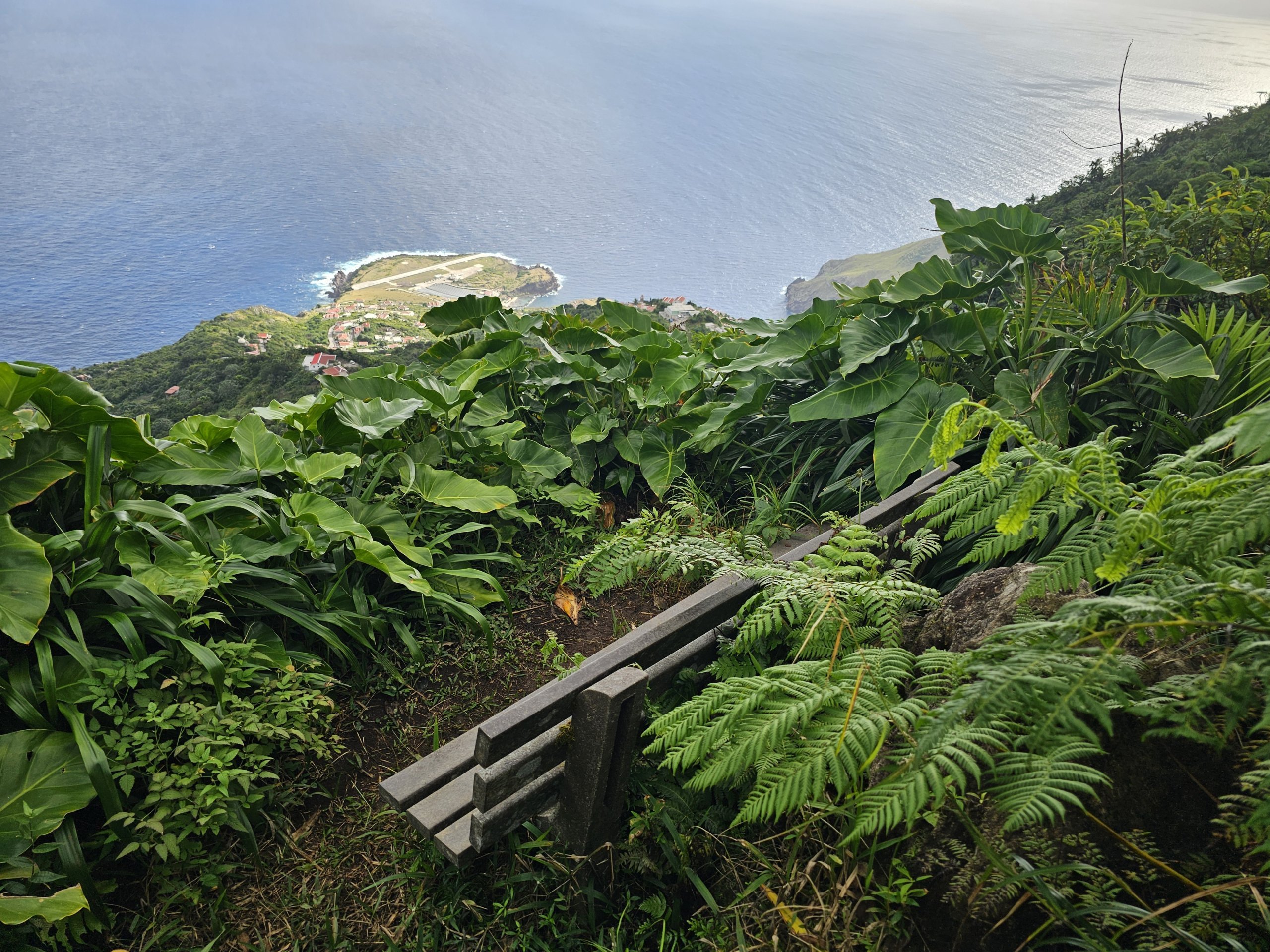
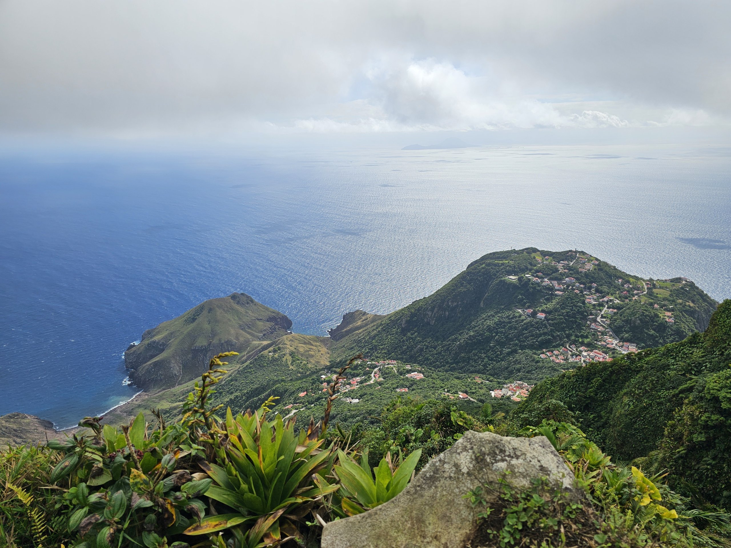
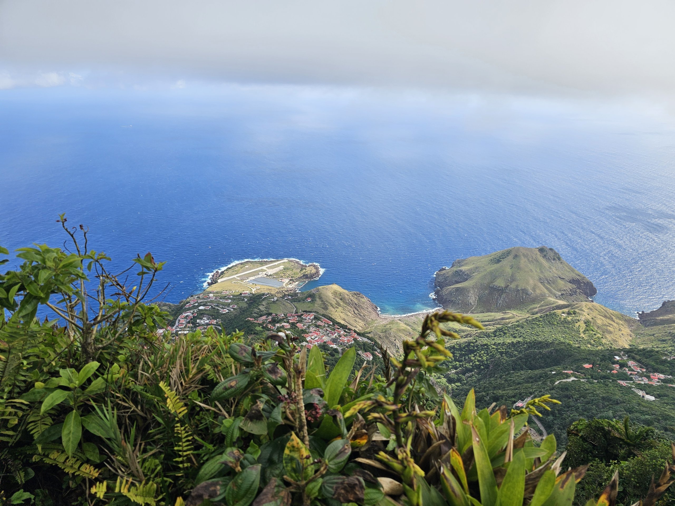
In our opinion, the most beautiful route to the summit is from the village of Zion's Hill, where the airport is located.
The trail starts near the center of the village in proportion and the start is shared with the Sandy Cruz Trail, which splits off after 20 minutes.
You'll continue on the Elfin Forest Trail steeply uphill. First you pass through dense forest, then between cliffs with breathtaking views of the airport and the northern Saba coast, and the last section of the trail takes you through the Elfin Forest, which has a truly prehistoric feel to it.
- Walking time up - approx. 120 minutes
- Walking time down - approx. 90 minutes
- Distance - 1,800 metres one way
- Elevation - 370 metres
You can extend your journey via the little-visited All Too Far Trail, which does not lead from the centre of Zion's Hill, but from its southern part near the sulphur mines.
Trail difficulty and equipment needed
None of the trails require climbing experience and all are suitable for casual hikers.
You must expect very steep climbs and descents, so basic fitness is essential.
After rain, the paths are either muddy or slippery and good hiking boots are a must.
There are no refreshment options on the trail and there are no springs with fresh drinking water. Grocery stores are only available in the villages of The Bottom or Windwardside, while you can't even buy water anywhere in Zion's Hill.
Views from the top
At the top, you'll come across an old transmission tower and two intersections where the road splits in two.
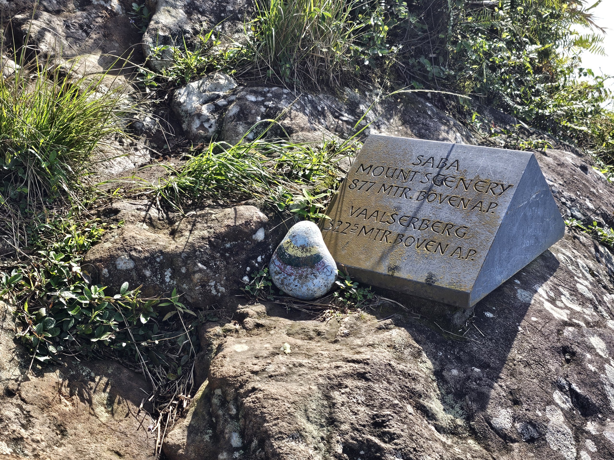
If you head right past the transmitter, you'll reach the lower of the peaks, where there's a plaque comparing the heights of Mount Scenery and Vaalserberg in the European Netherlands.
If you head left, you will reach the 877m high summit of Mount Scenery itself.
The views are breathtaking, although you have to take into account that the summit is often shrouded in cloud. Usually, however, you just have to wait half an hour or an hour and the clouds will part, at least partially.
What to see around
Discover all the places to see in Saba.


Any questions left?
If you have any questions or comments about the article...

On the island of Saba it would be a sin to skip the climb to the highest peak, and if you have to go uphill, a local tap will come in handy (ascent or descent via Windwardside).
For inspiration: https://www.michalzhor.cz/2025/0...ecna-saba/