

How to have fun on the small island of Saba? And why go to Saba at all?
Hiking
Although virtually the entire island is filled with just one single inactive volcano, Mount Scenery, there are several marked and maintained hiking trails on Saba.
Hiking enthusiasts won't get bored on the island even after 3 full days.
What do the trails on Saba look like?
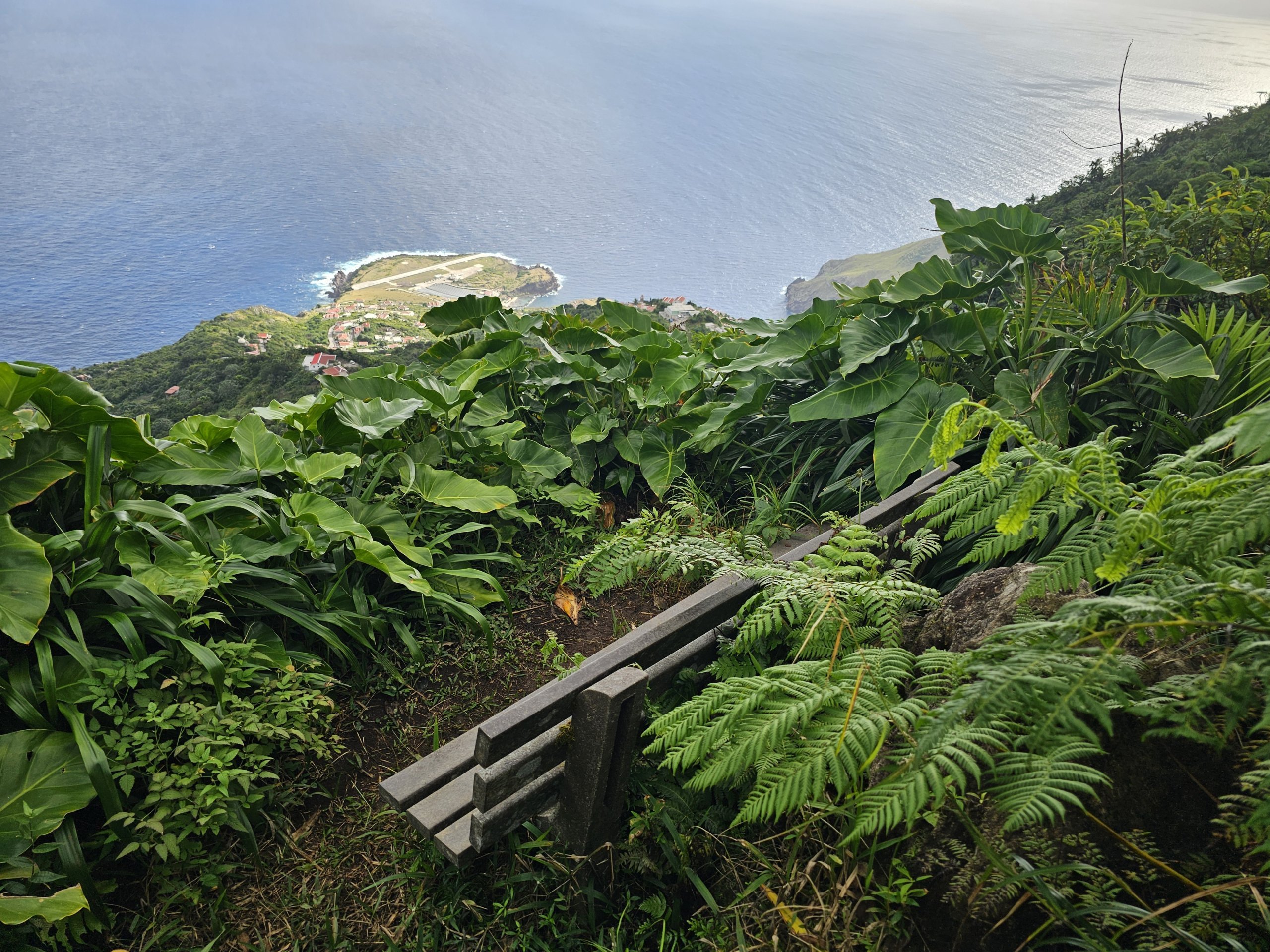
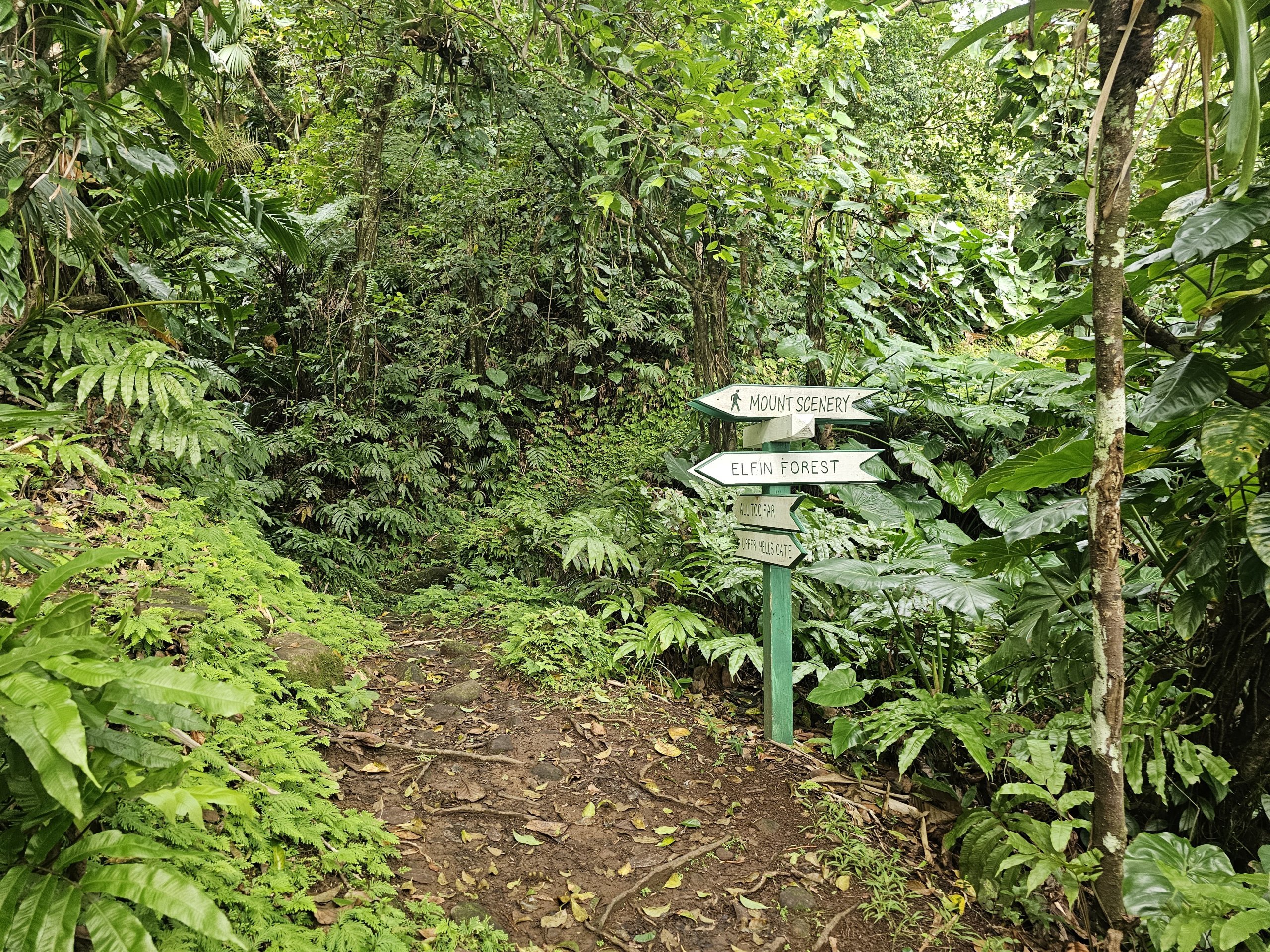
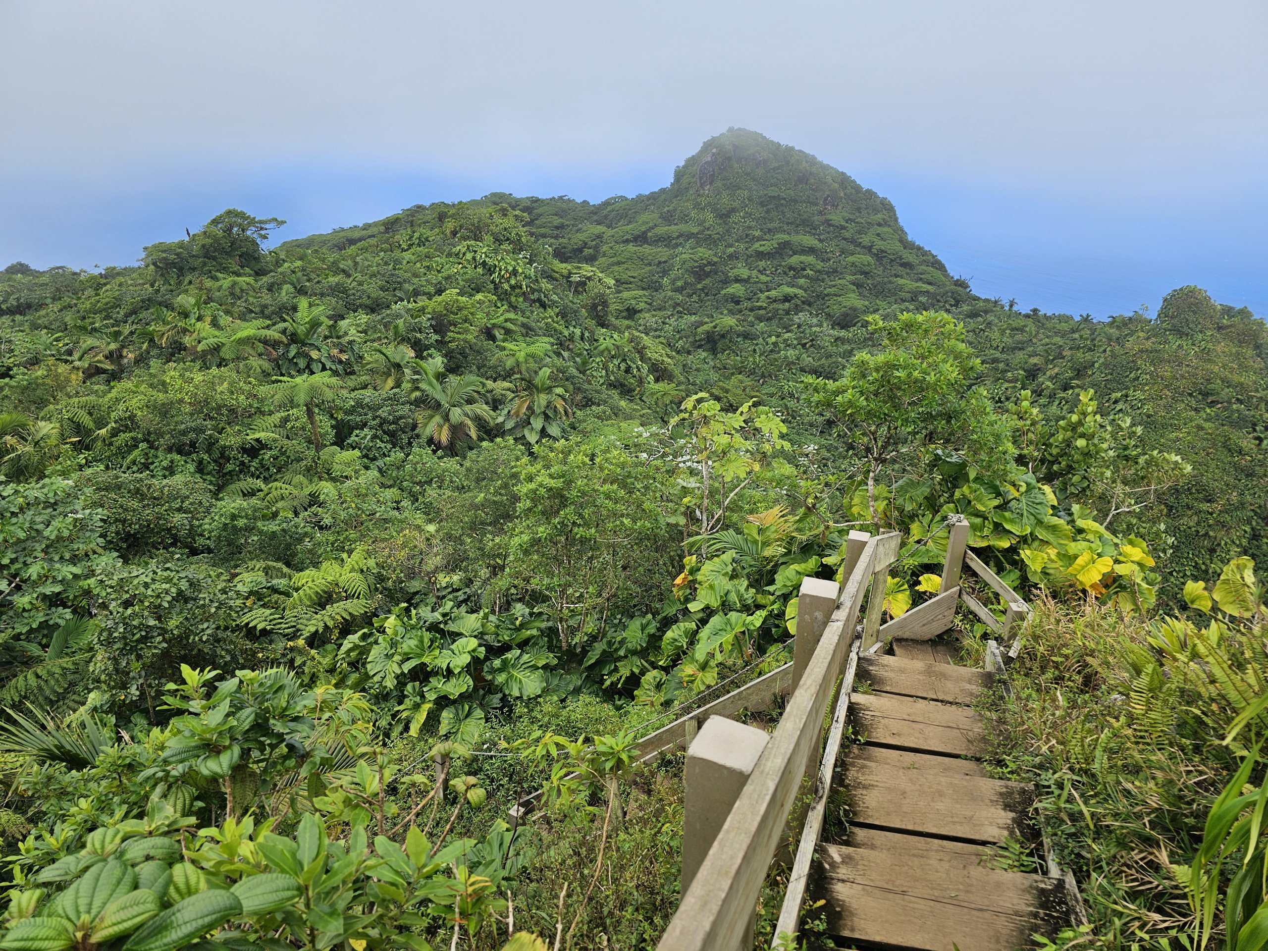
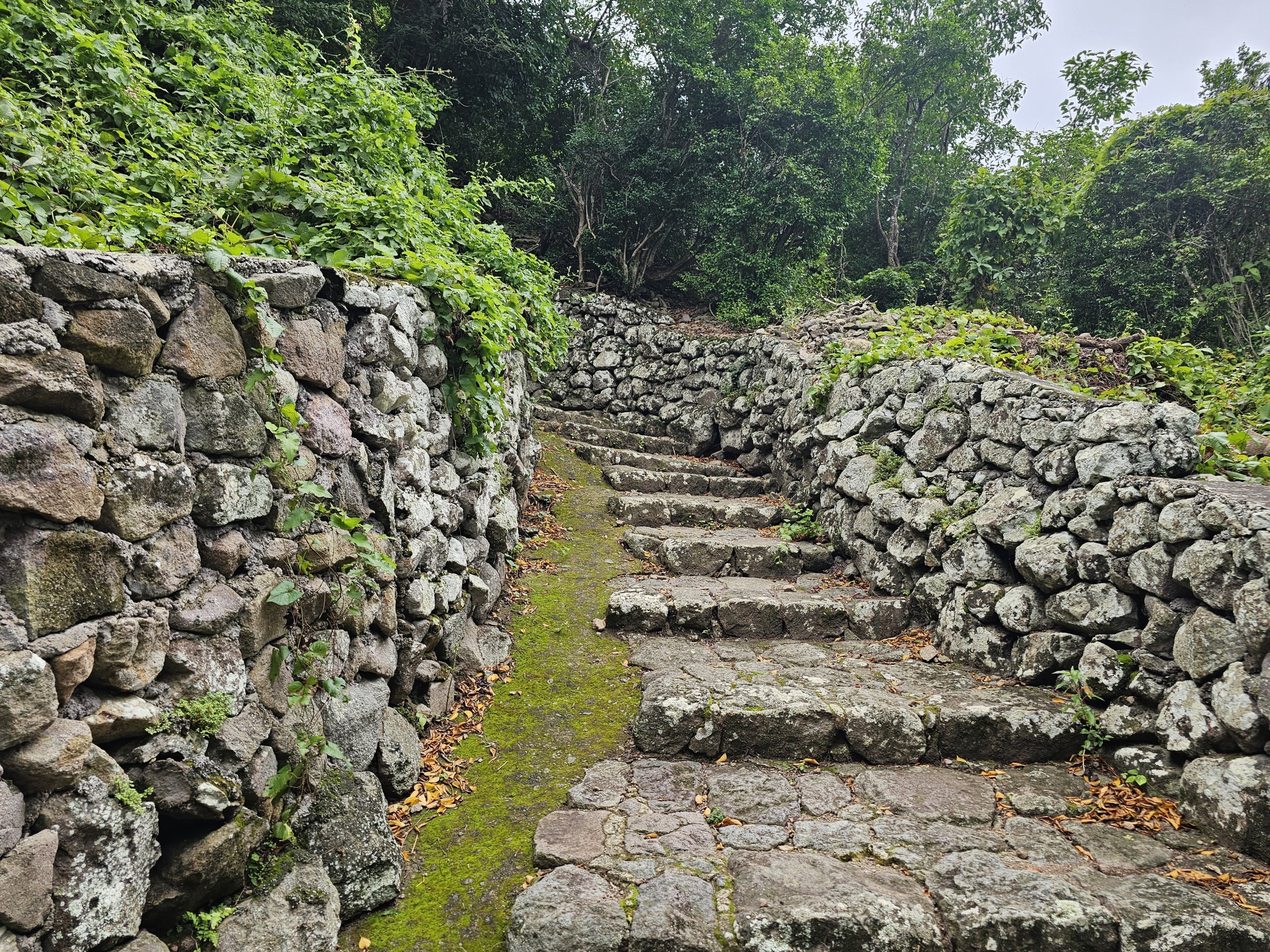
All the official trails are well-maintained and equipped with signposts, handrails or wooden and stone stairs in dangerous sections, and the most famous trail from Windwardside to Mounte Scenery even has a few benches and shelters.
Refreshments can be purchased at grocery stores in the communities of Windwardside or The Bottom. There is no store in the village of Zion's Hill, but at least water can be purchased at the Saba Airport bar (0.5 litre water for 2 usd).
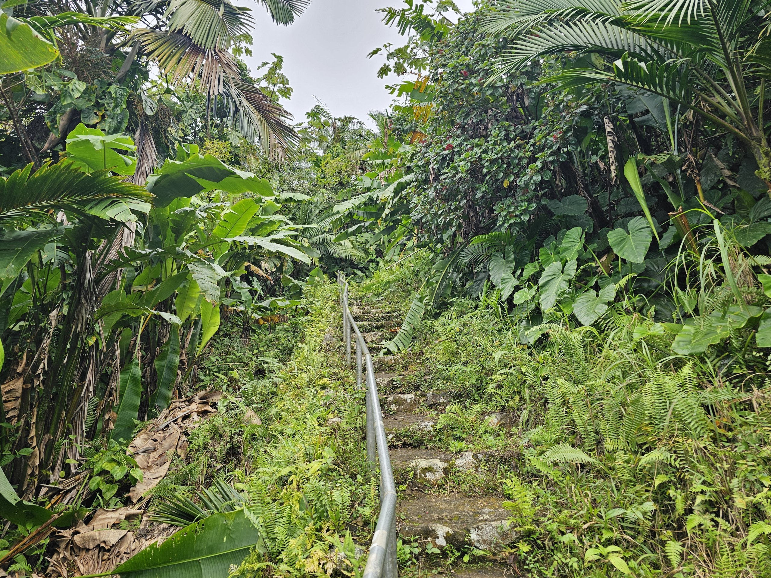
However, you always have to allow for more challenging sections full of rocks or mud, and the roads can be very slippery after rains.
All the routes marked below can be climbed without mountain experience and you definitely don't need climbing equipment.
However, good quality hiking boots are a must for the longer routes.
What are the best routes on the island?
Where do the hiking trails lead to and from, and how difficult are they? On Saba, there are plenty of trails to choose from for the fit hiker, but also for the less trained traveller.
Mount Scenery Trail
The most famous and best maintained trail leads from Windwardside to the highest mountain, Mount Scenery.
The trail runs on smooth rocks and there are guardrails and several shelters along virtually the entire length. The elevation gain is high, but the easy terrain makes the path from Windwardside to the summit the easiest.
- 115 minutes uphill / 75 minutes downhill
- 1.8 km
Elfin Forest Trail
A lesser known trail to Mount Scenery leads from the village of Zion's Hill and is much nicer than the trail from Windwarside.
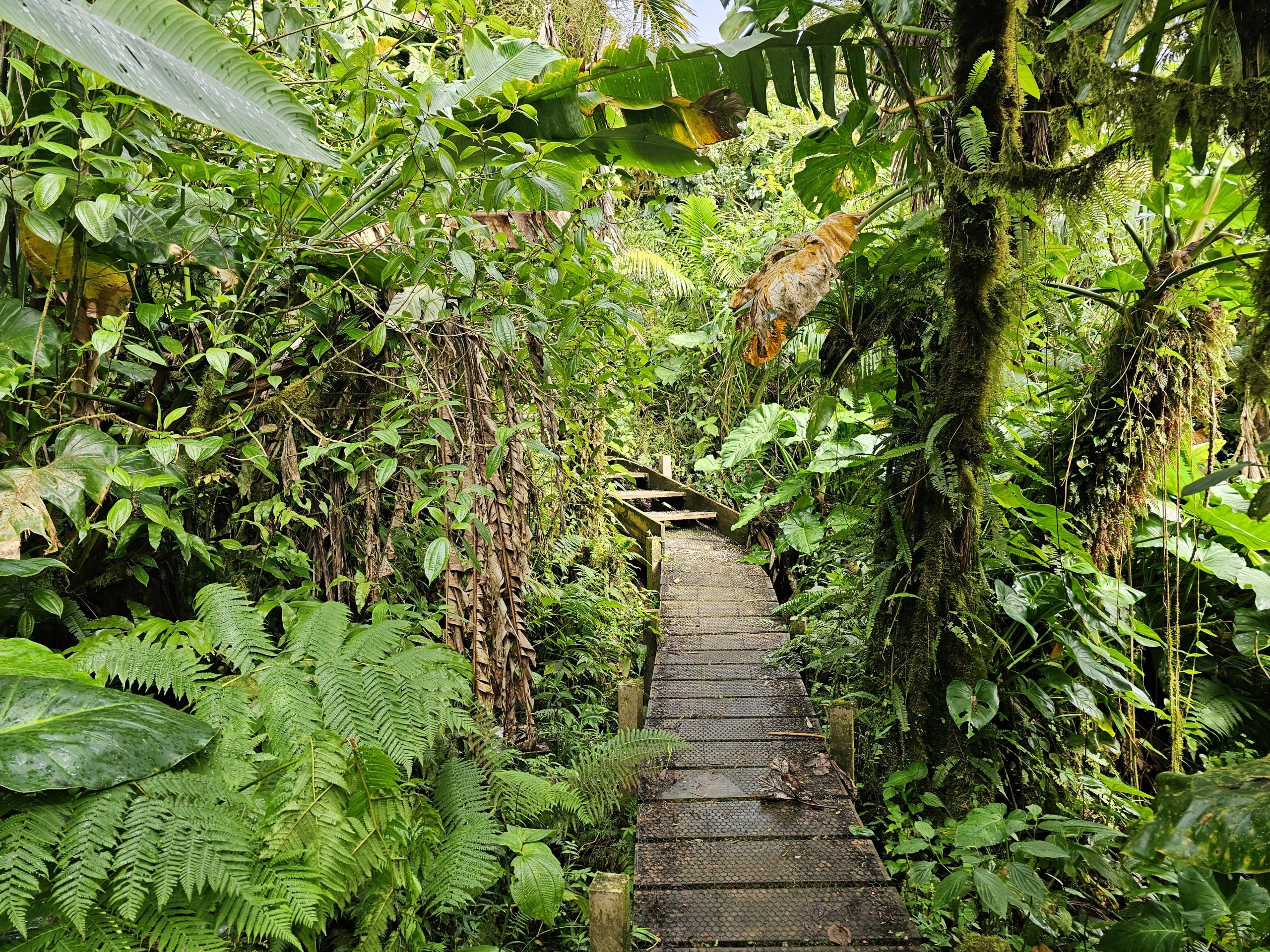
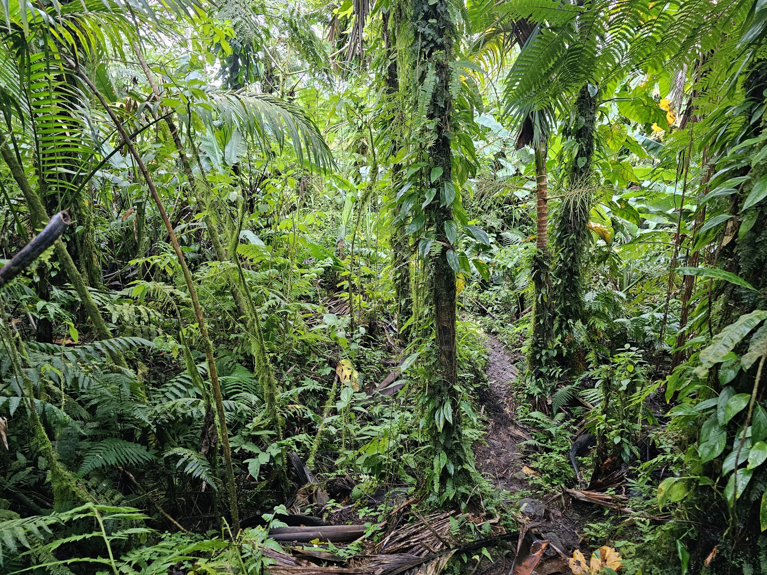
In fact, it runs through a beautiful forest and is not nearly as constrained by landscaping as the Mount Scenery Trail. During the first half of the trail, there are breathtaking views of the North Shore with the airport.
- 120 minutes uphill / 100 minutes downhill
- 1.8 km
Crispeen Track
A variation of the Mount Scenery Trail that splits off at its bottom and leads to The Bottom instead of Windwarside.
The trail goes through the woods and is quite rocky, but still very passable.
- 80 minutes up / 40 minutes down
- 1.4 km
Spring Bay Trail and Kelbey's Ridge
This long and very rugged trail follows the wild eastern shoreline from the bottom of Zion's Hill steeply down the cliffs to sea level at Spring Bay and then steeply up across wide plains with great views to Windwarside.
- 150 minutes towards Windwardside / 115 minutes towards the airport
- 2.8 km
Giles Quarter Trail
A long trail along the south coast of the island leads from Windwarside across grassy plains with wide views to the sea. Then along the coast through the quarry to the harbour.
The way down is relatively easy, but you have to expect steep descents and very rocky sections.
- 90 minutes towards the harbour / 150 minutes towards Windwarside
- 2.8 km
Sulphur Mine Trail
This very short trail to a former sulphur mine is ideal for short trips for less fit travellers who also want to see the truly wild north coast.
The trail is steep but short and has no downright dangerous sections.
- 20 minutes downhill / 30 minutes uphill
- 550 metres
Middle Island Trail
This pleasant and easy trail through the woods on the west coast is suitable for less experienced travelers and can be combined with a trip to Well's Bay.
- 30 minutes
- 1 km
Parish Hill Trail
A great accessible trek that starts and finishes right in the town of The Bottom and leads to nearby Parish Hill.
It offers breathtaking views of the town, the sea and Mount Scenery. The trail is often closed on weekdays due to grazing goats.
The elevation is very steep in places and the road is quite rocky.
- 65 minutes
- 1 km
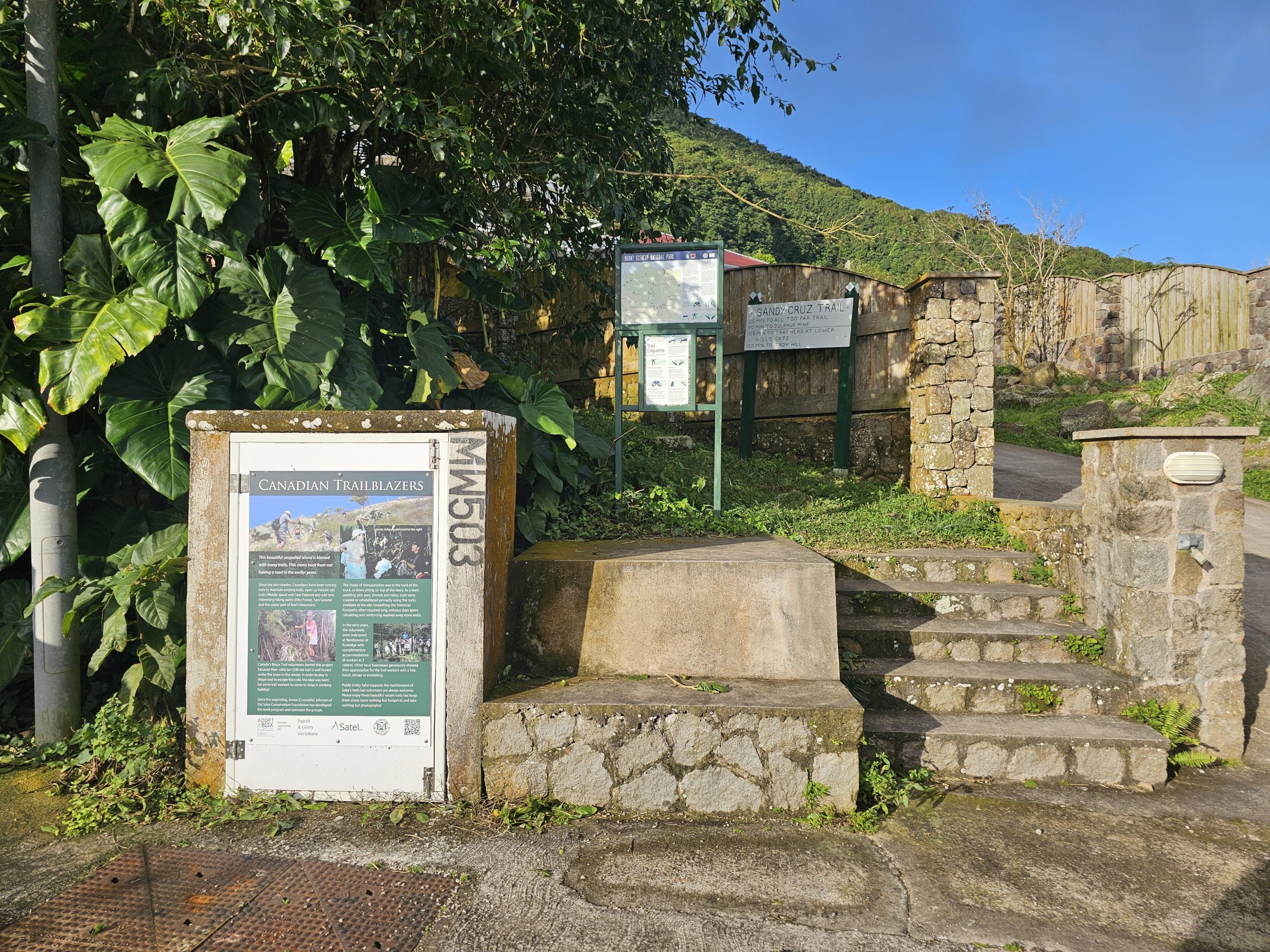
Sandy Cruz Trail
The trail runs continuously along the side of Mount Scenery and from the map would appear to be mostly contour. However, short very steep sections are unavoidable.
More downhill is the trail from Zion's Hill towards the town of The Bottom.
The Sandy Cruz Trail leads through beautiful jungle, but often offers great views of the coast and sea.
- 120 minutes
- 2.5 km
Mary's Point Trail
This trail is one of the newest and takes you from the road leading to Well's Bay up a steep hill to the archaeological site of Mary's Point (Palmetto).
The trail is very steep but short and well maintained with no dangerous sections.
- 45 minutes uphill / 30 minutes downhill
- 1.2 km
All Too Far Trail
This interesting and very little-visited trail connects the Sulphur Mine Trail and the junction of the Elfin Forest Trail and Sandy Cruz Trail.
It is an interesting and significantly longer alternative to walking from Zion's Hill to the top of Mount Scenery. It runs mostly through dense jungle.
- 90 minutes uphill / 60 minutes downhill
- 1.6 km
Map of hiking trails on Saba
You can see where all the marked trails on the island lead on our map.
The map is up to date as of 2024.
Official information from the Saba Tourist Board can be found at: sabatourism.com/hiking.
Are there dangerous animals on Saba?
You often wonder if you will encounter dangerous wildlife while hiking on the island.
There are no large carnivores or venomous snakes or insects on the island. Saba is home to only one species of snake called Red-bellied Racer, which is not venomous.
Unlike other Caribbean islands, stray or free-roaming dogs are not common on Saba.
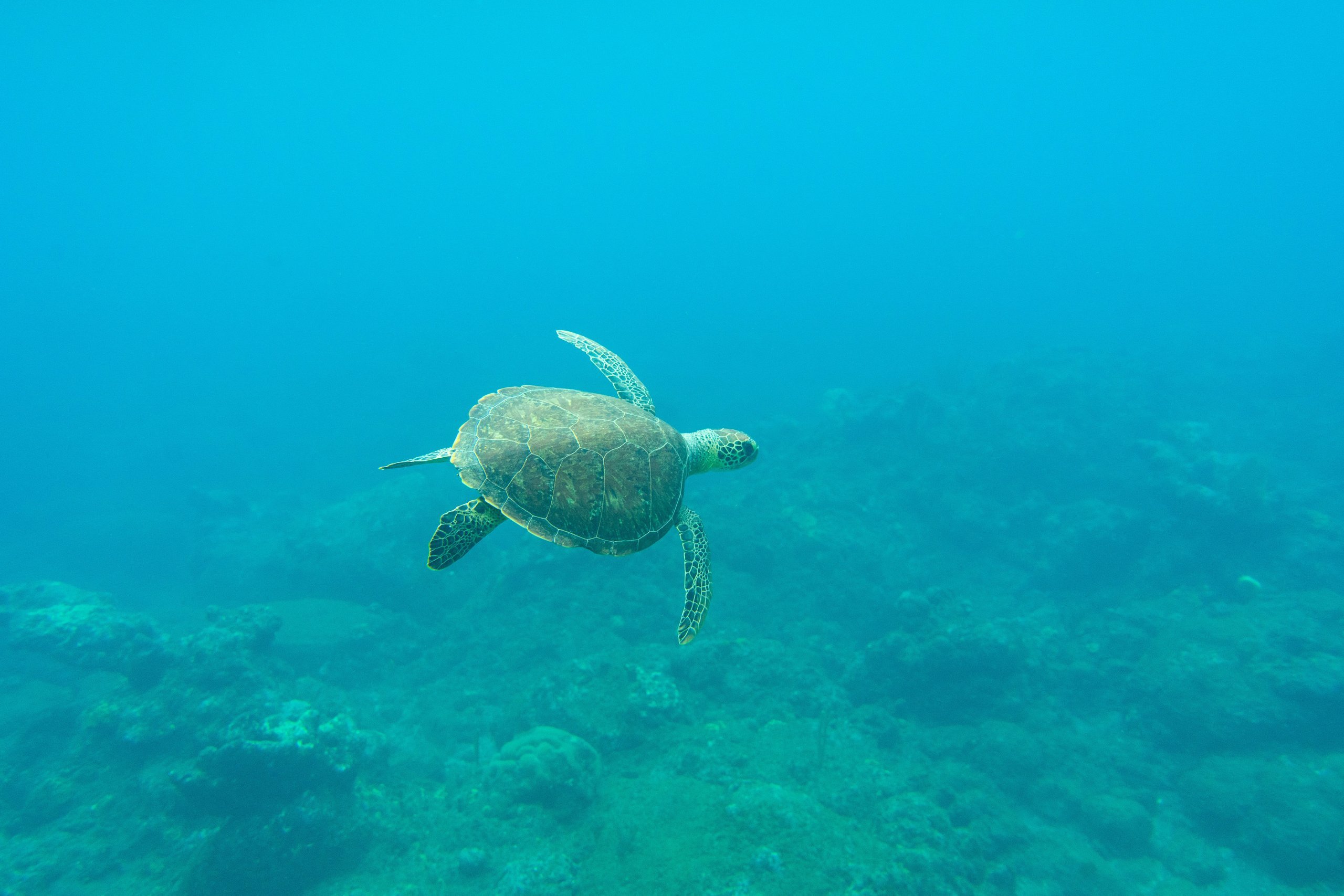
Diving
Don't just stay on dry land and discover the rich underwater life too.
As steeply as Saba rises from the sea, it also descends into the depths of the Caribbean. Volcanic activity underwater has created incredible formations, reefs and underwater caves teeming with life.
There are more than 25 dive sites in the vicinity of Saba and even some suitable for snorkelling only.
Due to the very steep shores, shore diving is not allowed on Saba, so you always have to pay for boat trips at a local agency.
Diving is possible all year round, as the water temperature stays around 25 °C all the time. However, conditions are better from December to April when it rains the least and therefore visibility is at its best.
Prices and agencies
There is currently one dive agency on Saba, Sea Saba, based in the marina.
If you arrive by plane, just contact the agency online via seasaba.com and you will be picked up by van straight from the airport.
Prices for trips with 2 dives start at 150 usd, with 3 dives at 200 usd.
If you only want to go on a half-day snorkeling trip, you will pay 39 usd + possibly 5 usd for equipment rental.
Detailed information about diving in Saba can be found on the website: seasaba.com.
Snorkelling without the need for paid tours is possible, for example, in Well's Bay in the west of the island.
Night sky viewing
There are no large towns on Saba and although there is public lighting along the road, it is very low intensity.
The nearest major source of light pollution is St Martin's Island, more than 50 km away.
This is one of the reasons why Saba provides excellent conditions for undisturbed night sky stargazing.
The best clear sky conditions usually occur in the Windwarside and Zion's Hill area between December and April.
Beaches and swimming
At the outset, it is worth pointing out that Saba is by no means a typical beach destination and relaxing by the sea should not be the main focus of your trip.
However, swimming in the sea can be a great refreshment after a day's hiking.
There are no long sandy beaches on Saba and in fact you can only comfortably swim in two places.
- Well's Bay - a rocky beach with a narrow strip of black volcanic sand lies in a photogenic area of high cliffs and coral reefs below the surface. There is about 5 meters of gradual entry into the sea, so you can swim here quite safely.
- Cove Bay - a small beach with large pebbles is located just below the airport and you can combine swimming here with a short 10-minute walk to the natural tide pools created by volcanic activity.
Neither beach has any facilities.
